Marine electronics have evolved spectacularly in the past 70 years. It was the clever Japanese brothers, Kiyotaka and Kiyokata Furuno, who in 1948 developed a device for detecting fish underwater.
Their small electronics firm, based in Nagasaki, commercialised this revolutionary technology. Initial devices printed out the sonar trace on a strip of paper, before small CRT tubes became practical and an on-screen display became the standard. The commercial availability of LCD displays in the 1970s finally allowed the creation of slim dashboard-mountable units that consumed relatively little power.
Similarly, it was the US military which developed the forerunner of the modern GPS system. Once the network was opened up for civilian use in the 1980s, a wide range of devices were developed to access the technology and accurately fix your position on the globe.
Early units simply provided latitude and longitude co-ordinates, which would then be manually plotted on paper charts. The marine electronics industry accepted the challenge to develop the real-time plotting software, overlaying these co-ordinates on government ordinance charts to produce the device we now know as a chart-plotter.
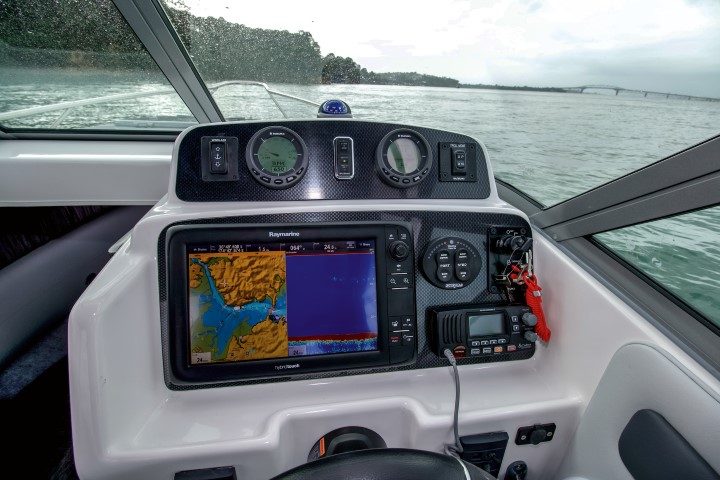
And yet, until relatively recently, these two core boating functions were usually on separate, dedicated, devices. Other navigation technology such as radar and AIS (Automatic Identification System, where the vessel actively broadcasts its own position to other vessels) each required their own display.
Added to this could be individual display units for engine monitoring, sound systems and video monitoring. It is not unusual for a commercial vessel (or even a larger recreational one) to have four or even more screens installed at the helm.
But most boats do not have the luxury of this much space. Also, although the information shown on the display may be quite different in each case, the basic technology of the screen itself is the same for all these functions.
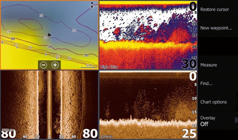
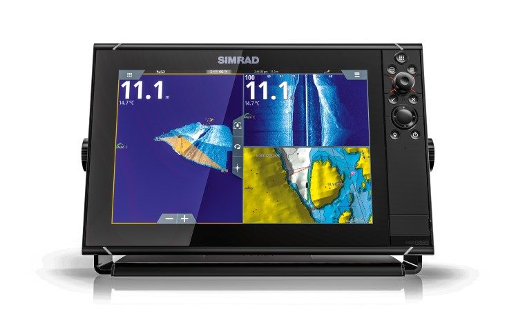
It did not take long before consumers began to demand multi-function displays, which can be switched between the various elements as required. As screen resolution and sizes increased it also became possible to split the screen in two, four or even six zones, each displaying a specific type of information.
As the software improved it was also possible to overlay data, so it is now common, for example, for chart-plotter, radar and AIS data to all overlay on the same marine chart, often with a contoured 3D display option as well.

Similarly, new sonar technology means that traditional down-facing sonar can be complemented with side-scanning and forward-facing beams, to give a full three-dimensional image of what lies beneath the boat as well as all around.
So how does a boatie choose what to buy when faced with this plethora of options? To add to the confusion, each manufacturer uses its own proprietary technology, displays the end result in a different way and calls it something different.
We’ve tried to establish what the terminology actually means, and explore the considerations for those with more than one helm station. No article can produce a recommendation for every vessel, but with a better understanding of the technology you can weigh up the features you require, the dash space you have available, and the budget you have to work with.
Terminology untangled
MFD: Multi-function display. This is the actual screen you see. These range in size from 5-inch to 16-inch, and even larger for commercial models. Smaller screen sizes are more likely to be single-use units (such as a fishfinder or chart-plotter, or both), while the larger models will support multiple functions depending on what inputs are provided.
Screen size: This is always measured across the diagonal, and most screens have a 4:3 ratio i.e. the screen is wider by about a third than its height. However, some manufacturers also produce 5:3 ratio screens, which lend themselves to being split vertically into two sections, such as chartplotter and fishfinder.
Touchscreen: Touch capability is now standard on almost all except the very smallest models, but for open runabouts where the helm station can get wet you should consider a unit which provides buttons as well. Trying to operate a touch-sensitive screen is nigh-on impossible when your hands are wet and the boat is bouncing around.
NMEA-2000: Devices ‘talk’ to each other over either a proprietary ethernet connector, or the industry-standard NMEA-2000. To share high-resolution images like charts and sonar data between two screens you generally require an ethernet connector, and so the MFDs generally need to be of the same brand although not necessarily the same model.
What NMEA-2000 allows is the exchange of numerical data between different types of devices, and allows, for example, the display of engine and fuel data on the same screen as your chartplotter.
SONAR: The technology used by fishfinders. Transmits a burst of high-frequency sound, then measures the echo. Lower frequencies (50kHz is common) have a greater range but are less good at identifying individual fish. High frequencies (200kHz) produce better resolution but don’t reach as deep. Almost all fishfinders available today, apart from the budget models, are at least dual-frequency, and many of them offer additional options.
Transducer: The part of the fishfinder that sits in the water, transmits the sound and detects the echo. Arguably the most important part of a fishfinder and the difference between a quality transducer and a cheap one can be quite startling.
The best placement of the transducer on the hull is a whole subject in itself. Note: most manufacturers offer several transducer options for each of their displays, depending on the intended application. Most standard transducers, regardless of the brand name on the box, are made by US-based company Airmar.
Transducers are rated in terms of output power, and naturally a 2kW transducer has more power, and so a greater depth range, than say a 1kW or even 500-watt model. For most inshore recreational fishing the power output is not that important, but game fishermen and commercial boats may require the higher power.
CHIRP: Compressed High-intensity Radiated Pulse. This is a sonar technology first developed by the military and now used in fishfinders from all major manufacturers. Instead of a burst of single-frequency sound, a CHIRP transducer sends a sweeping range of frequencies.
This resolves objects better than the traditional sonar beam, and CHIRP is often stated to be best for identifying fish. Again, all except the very cheapest model fishfinders are likely to have CHIRP.
Sidescanning Sonar: This is called variously Sidescan, Sidevision or SideVu, and essentially adds two smaller side-facing transducer elements to either side of the main element inside the transducer block – which then becomes elongated.
This lets you see what is either side of the boat, not just what is below. This can be a real benefit, especially when hunting for a particular structure or feature since you do not need to go right over it to find it.
3D Sonar: Known as Totalscan, RealVision or Panoptix, this feature combines inputs from the various transducer beams to display the sea floor as a three-dimensional image.
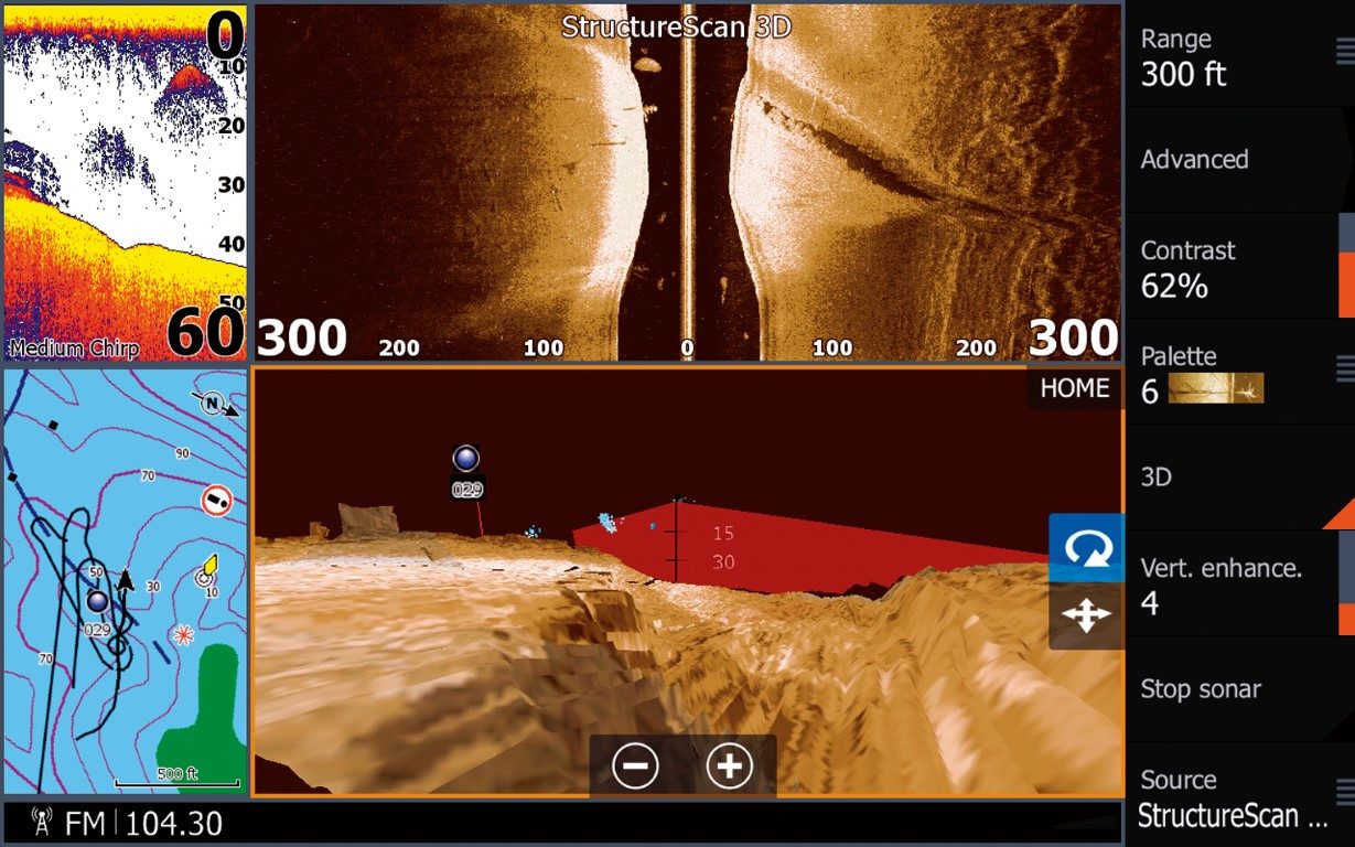
This is one area where the differences between the brands is most apparent, and what looks ‘best’ can be a very personal choice. When choosing a unit, find a retailer that supports multiple brands and compare them side-by-side to see which you prefer.
RADAR: Radio Detection and Ranging, this is an ‘active’ system for detecting objects. Similar to sonar in that the radar dome emits a pulse and then detects a return echo, radar uses radio waves rather than sound.
Traditional radar systems required large, rotating antennae, which transmit strong electromagnetic radiation that can be hazardous to human health. The latest solid-state radar units from all the major brands have reduced both the cost and radiation hazard of installing a radar on a smaller recreational vessel, and most MFDs have the option of adding a radar capability.
Note: This technology has made rapid gains in the past few years and will be explored in more detail in next month’s issue.
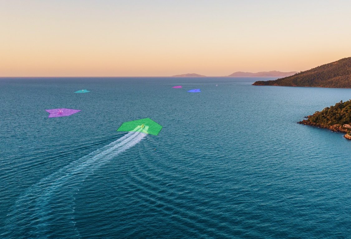
AIS: This is a ‘passive’ vessel detection system, which detects the AIS transponder that is mandatory for all commercial vessels. AIS is an essential piece of kit for offshore, cruising boaties who are concerned about commercial shipping, and integrated units overlay the other vessel’s details onto the chartplotter display.
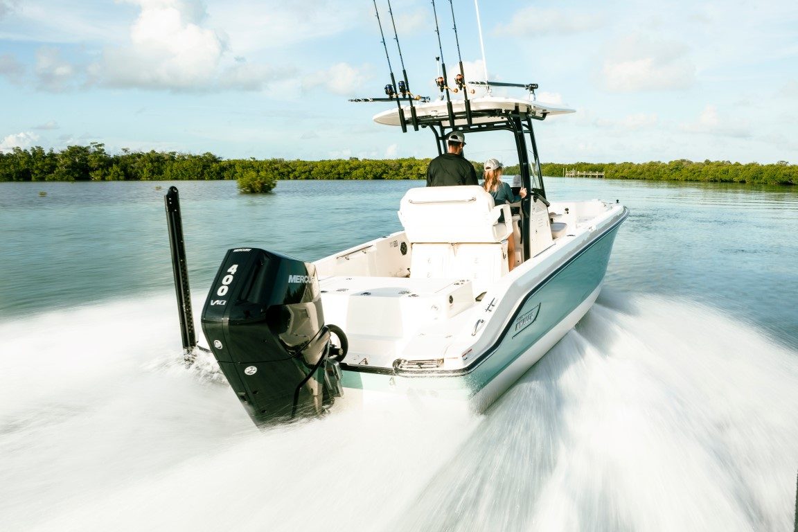
Engine interface: Most newer engines, both inboard and outboard, will have an optional digital engine interface to output the engine data onto the NMEA-2000 network.

This enables your engine data to be fed into your MFD and either displayed on a dedicated section of the display, or overlaid onto the chart of fishfinder. This is especially helpful for a secondary helm, where a single MFD can replace the need for additional engine gauges.
Autopilot: When connected to a hydraulic steering system, an autopilot enables you to set the boat’s course and lets the boat drive itself. Fully-integrated systems even allow you to plot a complex course to steer around obstacles such as islands.
Cameras: Bigger MFDs often have one or more digital video inputs, allowing the inclusion of underwater cameras, engine-room cameras and even thermal and infra-red night vision systems.