A recent three-week stint for a boat’s routine maintenance at Robertson’s Boatyard up the Mahurangi Creek evolved into a fascinating voyage of discovery for Alex and Lesley Stone.
Our days on the Mahurangi River and a trip to nearby Warkworth gave us a fresh perspective of this previously un-prepossessing (to us) town. We would dinghy-commute to the supermarket and the sushi place for lunch, tie up at the dock and enjoy the shaded riverbank park. And at the end of each day, we’d take off for the same short distance downriver, for a refreshing dip in possibly the world’s best swimming hole.
There’s much to see and learn up the Mahurangi inlet – it’s full of history and intrigue. For a start, it might have been New Zealand’s capital. In 1840 Governor Hobson sent one Felton Mathew and his wife to check it out, as part of his search for a new capital for the fledgling colony. Mathew reported fulsomely on the sheltered nature of the Mahurangi Harbour, and the ‘profusion’ of kauri on both shores. He thought it was ‘admirably adapted for the site of a town’.
He added, with typical colonial naivete: “Several Europeans lay claim… to this portion of the country, but their titles, I am informed, are of no value. And even among the [unidentified] native chiefs a dispute exists as to the rights of ownership. The Government should therefore have no difficulty in taking possession of it [!]. I did not see the slightest trace of native inhabitants during the time I was in the place.”
In the end, though, they decided on another place in the Waitemata Harbour for their fledgling capital. A year later, a huge block of land around the Mahurangi was bought in the (still contentious) Mahurangi Purchase. The price paid to a group of absentee-landlord rangatira was paltry.
Today, most New Zealanders’ experience of Warkworth relates to being held up at the awkward seven-way intersection of confused and confusing traffic lights on State Highway 1 (locals call it ‘The Dog’), with roads leading off to Matakana, Tawharanui Marine Reserve, Sandspit and Algie’s Bay. It’s one of the reasons for the new bypass highway being built from Puhoi northwards.
But few consider Warkworth a cruising destination port despite its town basin public dock able to berth reasonably big boats – including New Zealand’s last active Hauraki Gulf scow, the Jane Gifford.
Up the Mahurangi Inlet
At the harbour mouth there’s the extraordinary Mahurangi Regional Park. There are three parts to it, only one of which is accessible by boat – the Mahurangi East Te Muri (two cottages, for rent). The second is the Otuawai Bay campsite and the third is the beautiful, nicely-sheltered boat-launching beach.
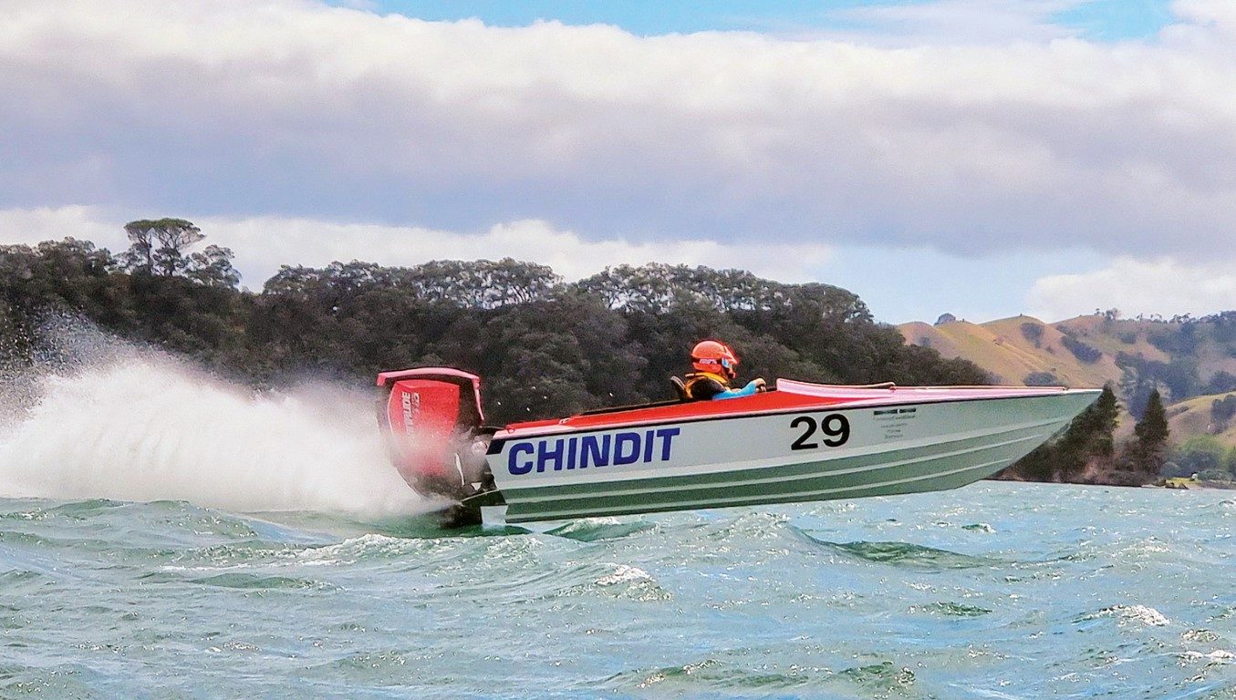
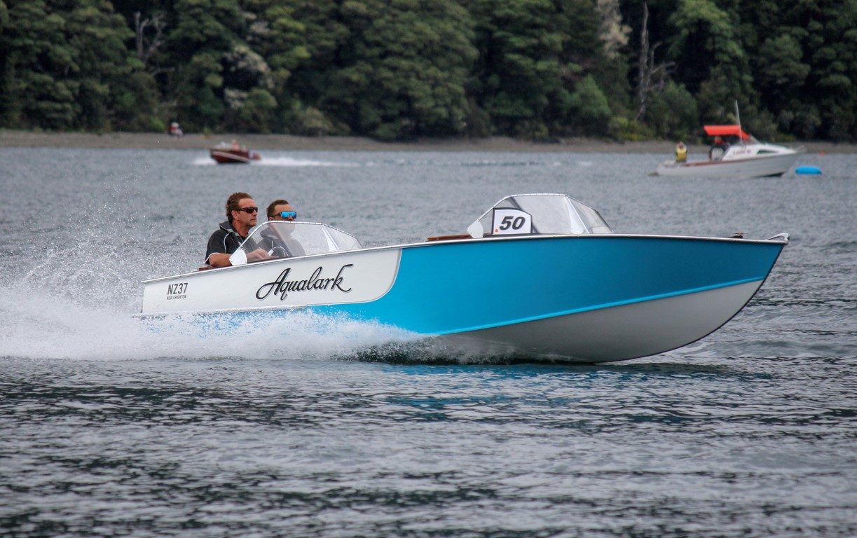
The waters off local Sullivan’s Bay are best-known for the annual Mahurangi Classic Boats Regatta in January, an event so organised it publishes its own yearbook. But then it does have photogenic material to die for – and lovely yarns from old seadogs.
The regatta is supplemented by fun stuff on the shore, and it usually culminates in the ‘humongous annual egg-throwing competition.’ The organisers are happy to consider ‘any other event suggested that seems a good idea at the time!’
The first Mahurangi Regatta is not remembered, but on New Year’s Day 1858 a farmer (Joseph Gard) noted in his diary that he saw the event in progress while passing up-river on his way home from Auckland.

Even at the open end of the Mahurangi, there are some worthy tuck-away spots. Just north of Mahurangi Regional Park, on the port-side shore going in, there’s Opahi Bay, where tinnies and sailing dinghies can be launched, and dogs can enjoy the beach. It’s very shallow-shelving though, so watch out at low tide.
Round the corner there’s Jamieson’s Bay (the best anchorage) with its near-secret public slipway. Extending from it are Huawai Bay (where there are a couple of low-tech haul-out facilities), and Pukapuka Inlet, a large tidal expanse.
On the starboard shore, there’s Lagoon Bay and Casnell Island, at the entrance to another deep inlet, this one leading up towards Algie’s Bay and Scandretts Regional Park. Casnell Island lies just off Scott’s Landing – at the end of a long, thin peninsula. There’s a public slipway and floating dock.

Anchoring off Scott’s Point can be tricky as this lies in the middle of the strong tidal stream (though there are many permanent moorings along the shore). The holding ground is contaminated with diverse bits of rusted iron junk – perhaps because this was a busy and pivotal place in the river’s history.
The nearby Scott Homestead, built in 1877 by Thomas Scott junior after the original building (known variously as the Scott Hotel, the Richmond Inn, Richmond Arms and the Mahurangi Hotel) burnt down. Opposite the Scott’s Landing peninsula is Browne’s Bay, site of the first European settlement in the Auckland region.
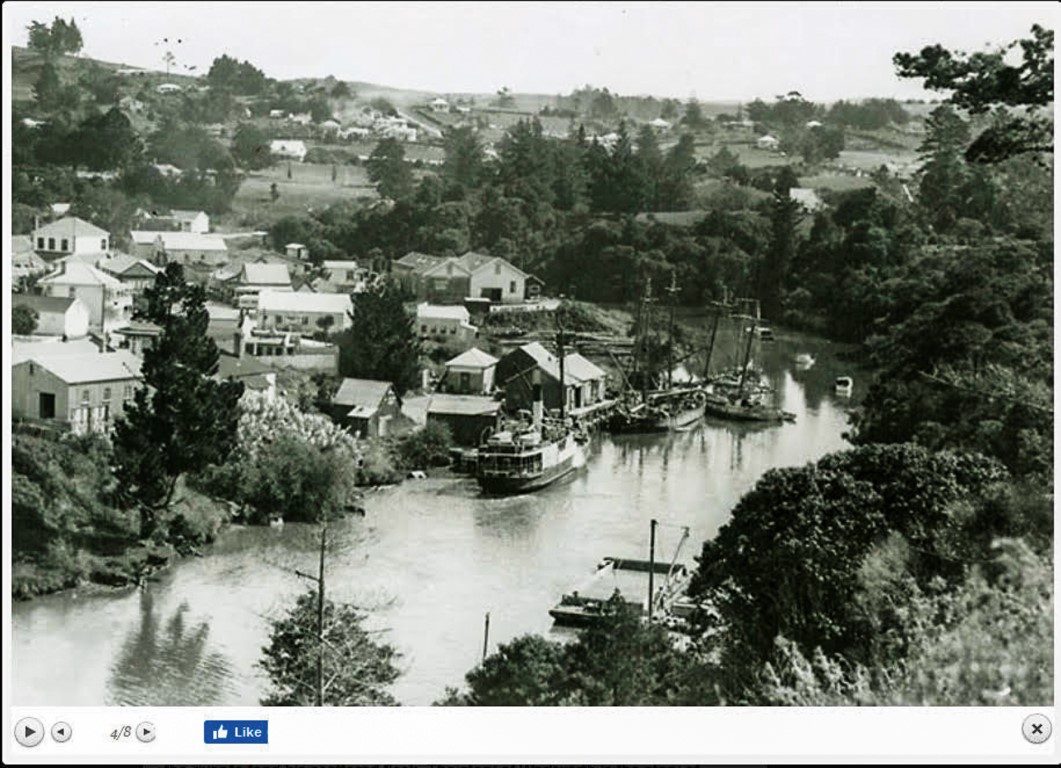
Captain Downie of HMS Coromandel sounded the harbour for the first time in 1820, labelling it Kyiahou Harbour. In other early documents Mahurangi was spelled variously as Mahranga, Mahurangi, Maurhangi, Mourangi, and Mourrangee.
The first chart of the harbour was drawn by Frank Cudlip in January 1834. He was mate on the kauri-collecting British Navy ship HMS Buffalo. He unimaginatively named (and mis-spelled) it as Mr Brown’s Establishment. This was the spot that Felton Mathew considered for the site of the colony’s capital.

You could write a book about the history of the Mahurangi. Some already have. There’s Jade River: A History of the Mahurangi by Ronald H Locker, and before that, Mahurangi – The Story of Warkworth, New Zealand by HJ Keys.
And Mahu Mag is a great website, well-stocked with historical images and stories – and current contentious environmental and political issues. Check out www.mahurangi.org.nz/magazine. It has some wonderfully arcane entries, such as ‘Great lesser boatbuilders of the Mahurangi.’
To get up the Mahurangi River, head due north from Scott’s Landing. You’ll encounter the first channel markers about a mile up, next to an oyster farm. To your left, on the hill above Cowan Bay is MacElroy’s Bush, the most significant block of native bush left in the region. The locals are all getting into a pest-trapping regime to create a pest-free peninsula.
At this stage, the channel’s pretty wide and easy, but where it veers left to the NW, beware of a cross-current in an outgoing tide, caused by water emptying the inlet on your right, which leads up to Snell’s Beach.

Things get interesting as the channel starts to head inland. You’ll probably encounter a digger on a barge dredging in midstream. Clearwater Dredging was initially commissioned by community groups wanting to keep the channel viable. They found the fund-raising hard going but a Government relief package during last year’s Covid lockdown got them digging again – presumably because they were already ‘shovel-ready.’
Some bends in the marked channel appear scarily close to the shore. Trust them – they’re following the deeper water on the outside of the curve.
After passing some private docks, you’ll come to Mahurangi Marina and boatyard. It seems to specialise in optimistic restorations of traditional boats. Nearby are the ruins of an old cement factory that burbled and bustled during WW1 and finally shut down in 1929.
The ruins were used as a location for the 1990s New Zealand TV series Marlin Bay (remember that?). That the mighty factory is now a mouldering ruin (with a Keep Out fence and warning signs everywhere about collapsing structures) is, methinks, hardly testament to the quality of the concrete it produced.

A wee walk behind leads to the superb swimming hole. It was once the limestone quarry for the works and has since filled with sparkling fresh water – a far cry from the muddy creek nearby – and a leafy green surround has grown around it.
The swimming hole is deep and so steep-sided that in places you can dive in from the shore. Young blokes display their worth by climbing a big willow on the far bank and bombing from a height. Mostly, it’s a cool family hangout. From the land the swimming hole is reached by following Wilson’s Road to its end.
The starboard side of the channel is mostly native bush all the way to Warkworth, dominated by some large tōtara. At low tide, the mudbanks are alive with crabs. And symbiotically, lots of happy kingfishers.

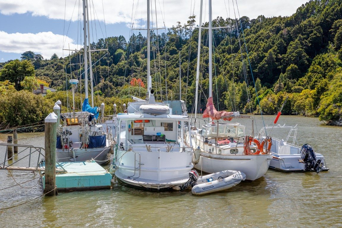
Robertson’s Boatyard
There’s one more bank-hugging bend to get to Robertson’s Boatyard. It’s a surprise to see a massive 85-tonne travelift capable of lifting boats with an 8.5m beam (catamarans welcome) – and it’s a lot more cost-effective than the haul-outs in Auckland. We’ve seen some really big boats up on the hard there – Fullers ferries, ocean tugboats, commercial fishing boats.
Drew Robertson is the young face of the yard. “It goes back about four generations,” he writes. “My grandfather’s uncles (Roy, Fred, and Mike Lidgard) started a boatbuilding business called Lidgard Bros in 1932. My grandfather Chris Robertson did his boatbuilding apprenticeship for them.
“In 1960 he started his own business based in Target Road on the North Shore. In 1981 the business moved to the site it occupies in Warkworth. The site was an old limestone quarry which took a bit of tidying up and they rebuilt the shed that had collapsed and used it for the construction of boats [same shed that’s there now].
“In 1995 my dad Conrad brought the business and has owned and operated it himself since. He designed and built the Travelift and dock and developed the hardstand area which went into service in 2000. The lift was to diversify the business into repairs and maintenance work, to supplement the custom boatbuilding due to the decline in custom boats being built. I would be the fourth generation here.”
Conrad was also an Olympian rower, winning gold for New Zealand at Los Angeles in 1984 in the coxless four. The recreational rowing boats you often encounter on the river (some equipped with groovy rear-view mirrors) are of his design.
At Robertson’s there’s something of a sad boat story. The 60-foot yacht Classique has been moored there for many years on a peppercorn rental (thanks to Conrad’s generosity). Classique would be a powerful ocean-crossing cruising yacht but lies in disrepair.
She was wounded when she broke her moorings in Auckland’s Shoal Bay, and the owners have been involved in a long-running legal tussle with the Auckland mooring authorities.

From Robertson’s it’s only five more minutes to Warkworth town. Past a kayak-launching floating jetty and a slipway – and there’s the town dock, with the Jane Gifford tied alongside. She’s run by a charitable trust and does regular outings and historical tours. She also plays committee boat for the Mahurangi Classic Boats Regatta.
Jane Gifford sits on the mud – as scows are happy to do – at every low tide. Beyond her, there’s space for perhaps a dozen more boats on the public dock. Yachts of up to 40 feet can tie up here for two hours either side of high tide (depending of course on their draft), and smaller launches drawing less than 1.5m can stay overnight.

Here’s how the rules for the town dock work. You call the Harbourmaster, and he refers you to the Warkworth ‘facilities manager.’ You call said manager – he says you should call the Harbourmaster. Which you do. Then some bloke there gives you a mouthful about those fullas not doing their job, etc.
So you just tie up anyway, and enjoy this inland ‘Up the Creek’ port