Picking your way around tropical reefs can be tricky at the best of times – but things get really awkward when your chart suggests you are near a hazard that might – or might not – actually exist. Story by Matt Vance.
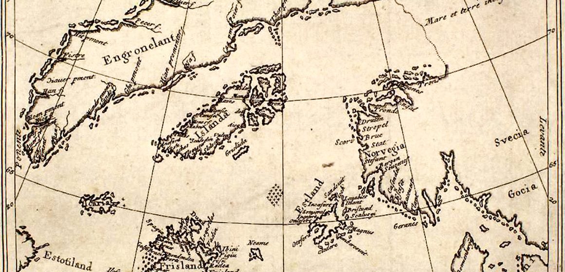
On the old Admiralty Chart that lay unfolded on Manaroa III’s navigation table was a dotted oval with the words Sandy Island (1876). This simple note was punctuated with the letters E.D.
It lay among the clutter of nearby reefs, the usual soundings of deep open ocean – and a small tea stain that had absorbed into the fine paper – and which now looked like a phantom reef in the Coral Sea.
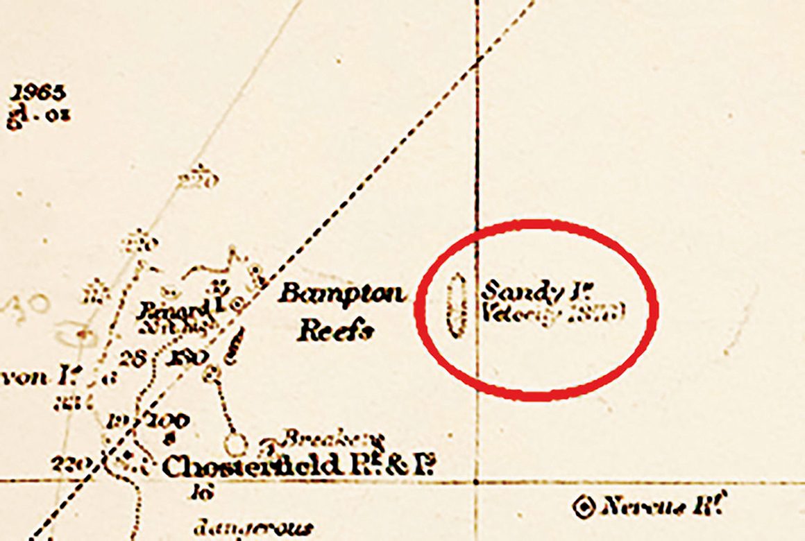
The letters stand for Existence Doubtful and how they got on the Admiralty Chart is a case of the power of authority over simple observation. Sandy islets and breakers were first sighted in the vicinity by the whaling ship Velocity in 1876. It was in an area near Bampton Reefs known for its atolls and low-lying islands.
Whether the crew of the Velocity saw a rip, a volcanic discolouration of the water – or were just in the wrong location – we will never know, but the island, as a dotted oval shape, was recorded and posted in notices to mariners. A few years later Sandy Island got a mention in an Australian Naval Directory and in 1908 its inclusion on the British Admiralty Chart lent the island even more legitimacy.
The British Admiralty spent much time, money and risk sending out voyagers to identify the many chart observations that had these dotted lines. Not knowing the detail of a world that the British Empire dominated with its ships was an annoying embarrassment.
The officers of Her Majesty’s ships were charged with hunting down the anomalies so that they could be scratched from the hallowed charts. In 1875 the Admiralty Charts were revised, based on a concerted effort to track down and discard 123 islands that did not exist.
The dotted lines of these islands had the letters E.D. printed beside them. Why the Admiralty never got to Sandy Island to confirm its existence and remove the doubt remains a mystery.
For sailors, even the faintest speck of land means danger so it is always being searched for and guarded against. Such is this sailorly respect for the land that once it had made it to the Admiralty Chart it had the momentum of authority which would carry it well into the 21st century.
Other forms of authority followed in step with the Admiralty when the National Geographic Society and The Times both included it in their maps of the Coral Sea.
By the time Google Earth came into being its sophisticated satellite imaging technology (mixed with a composite of existing charts and maps) was able to locate and include Sandy Island on its comprehensive coverage of the entire planet.
Strangely enough in 1982 the French survey of the waters around New Caledonia and the Coral Sea did not include the island. The Russian chart of the area completed in 1967 also seemed to overlook the island, yet the 2010 Michelin Map of the World included it.
Cracks were beginning to appear in the one thing most cultures view as a solid certainty – and that is land.
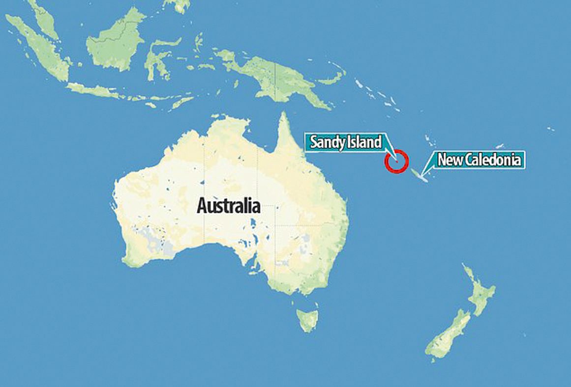
In 2012 the Australian survey vessel R/V Southern Surveyor stationed in the Coral Sea was engaged in a plate tectonic survey when one of the officers noticed a discrepancy between charts. Sandy Island was recorded on one of the charts but not on the others. Being in the vicinity of the island, the Captain decided to investigate. The Southern Surveyor arrived at the coordinates for Sandy Island and found nothing but ocean with the depth sounder reading over 1400m of water. Sandy Island had been officially undiscovered.
In the more than 136 years since it was first reported, Sandy Island had been given all the credence of a terra firma. Perhaps because we invest so much of our identity in islands, the ones that disappear through violent eruption or bombing are very disconcerting. The ones that disappear because they never existed are even more disconcerting and strike at our arrogance in believing nothing has escaped the laser vision of colonisation and technology.
Only a small minority of sailors read Admiralty Charts and an even smaller minority of ships’ officers ever read the Notices to Mariners. Sandy Island’s embarrassing disappearance could have been pulled off while everyone looked the other way, had it not been for the absolute trust mainstream society puts in technology.
On Google Earth, Sandy Island appeared as an oval island 15 miles long and three miles wide. It looked like a great place for a mid-ocean picnic or an overnight camp under the shimmering tropical stars. This giant of a corporation and purveyor of geographic truth had placed it there presumably because the Admiralty Chart said it was there, but on 26 November 2012 Google Earth deleted Sandy Island and patched the hole with a generic sea pattern.
When a void is created in a landscape it is immediately filled with our imagination. In the old version of Google Earth I have on my computer the position of the island is crowded with images of the fantasies that people have projected onto the place. Most of these fantasies involve paradise and it seems some involve dinosaurs and UFOs. Like mourners at a funeral, they turn up too late hoping to communicate their heart’s desire to the departed.
We live with the expectation that the world is fully visible and everything is known yet it seems we need islands that allow our thoughts to roam unimpeded like a tea stain on a chart and against the all-seeing eye of Google and the British Admiralty.


