
The app’s designed and produced by Sail South Pacific – a company owned by John and Lyn Martin (formerly of the Island Cruising Association) – and it is perhaps the most comprehensive (and easy-to-use) guide to sailing around the New Zealand coastline.
And best of all, it’s free (well – mostly free. More on this in a minute).
Covering New Zealand’s main cruising areas – top of the South Island with the Marlborough and Nelson regions, to the top of the North Island, the guide’s designed for all boating lifestyles.
 It follows on the success of two similar apps the company produced for our Pacific Island neighbours – Sail Tonga and Sail Fiji. This latest one, though, is a lot more comprehensive.
The app’s exclusively configured for an Apple iPad – it won’t display on iPhones and doesn’t work on Android tablets. But depending on the app’s uptake, says Martin, an Android version could be produced.
How it Works
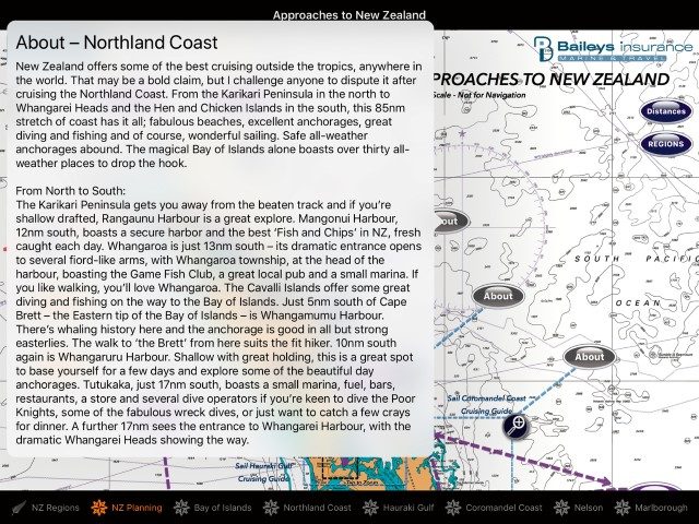
At this point, the Sail NZ Cruising Guide App covers five regions – Northland, Auckland, Bay of Plenty, Nelson and Marlborough. More regions will follow as the app is expanded to other areas.
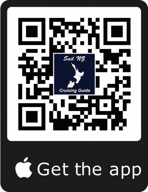
The basic ‘platform’ is free and can be downloaded from the App Store at https://itunes.apple.com/nz/app/sail-nz-cruising-guide/id1292992642?mt=8. The file size is (currently) around 346Mb. Downloading is easy using the QR code overleaf.
The free platform provides plenty of useful information, but if you want more detail for any of the regions, you buy the relevant add-ons.
Using the app is simple. Tapping on the icon opens the Regions Menu. This has a full description of each of the five regions covered in the guide.
To go to the Planning Guide, tap the icon in the footer next to the Regions tab. Tap any of the icons on screen to ‘drill down’ to more information.
In the free planning guide, you’ll find all the resources you’ll need for planning your cruise. And because most of the information is embedded in the app you can view it ‘offline’. It is only the web links and the Sky View that need an internet connection.
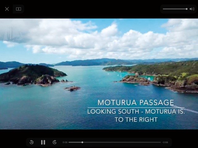
In this first release of the app (Issue 1), details of destinations, routes, marinas, facilities, activities in the five regions are provided. These are supplemented with overhead videos – and tapping on one of the many ‘Sky View’ icons provides an aerial perspective of the area you proposing to visit.
Issue 2 – to be released later this year – will include the rest of the South Island and Stewart Island. If you’ve downloaded the app before Issue 2 is launched – don’t fret – updates are free for life.
Once you’ve planned your cruising, you might want more, in-depth information about your destinations.
This is available with the ‘in app purchase’ – one for each of the regions – and you buy these.
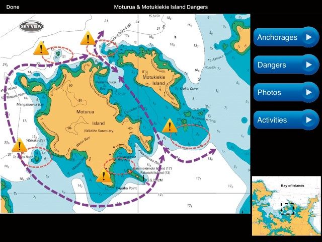
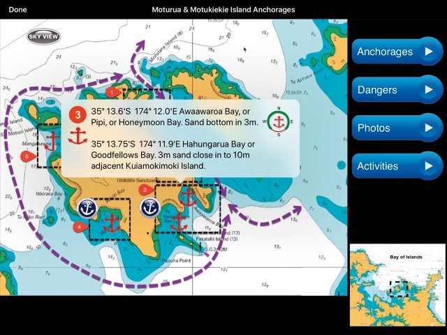
These local cruising guides provide detailed information for navigating the region: planning info, waypoints, hazards and cautions, where to go and, more importantly, what to avoid.
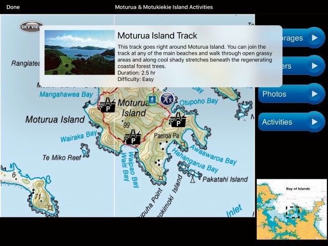
‘Drill down’ to individual anchorages for information on bottom conditions, prevailing winds in these anchorages, whether anchoring is recommended and activities to do while you’re there.
There is also a slide-show of images – so you’ll know what to expect. The (growing) library of Sky View videos gives an aerial perspective – these are ideal for orientating you to the surrounding area.
Stress-free cruising? There’s an app for that. Hover your iPad over the QR code (right) and click to download.
Pricing (in NZ$)
The supplementary add-ons for each of the five regions in Issue 1 will be available by Christmas.
• Bay of Islands – already launched ($18.95)
• Northland Coast – already launched ($18.95)
• Hauraki Gulf – in production ($28.50)
• Coromandel Coast and Gt. Barrier Island
– in production ($18.95)
• Nelson-Marlborough – in production ($28.50)
Note: there is a special limited-time-bundle for the first three of the above for $49.50. And when the last add-on is launched, there will be a limited-time-bundle price for all five cruising guides of $74.95. All prices include GST.
For more information email john@southsailpacific.com


