


Lyttelton Harbour is on Christchurch’s back doorstep, but its many and varied boating opportunities are often overlooked by locals and visitors alike.
Whakaraupō/Lyttelton Harbour is the marine backyard of one of the country’s biggest cities, but it’s often under-rated or taken for granted by Canterbury boaties.
That’s a shame because the harbour offers a diverse seascape and landscape, as well as a rich cultural history, all of which is easily accessed and enjoyed. What follows are some fresh insights, options and ideas for late summer (and beyond) boating on the harbour.
The main physical characteristic of Lyttelton Harbour boaties need to consider is the fact the waterway faces east and, because steady easterly/north-easterly winds are a very regular presence in the region, the breeze tends to blow directly up the harbour. This can result in short, messy and choppy seas which can create unpleasant boating conditions especially on an outgoing tide. Furthermore, it’s not uncommon to experience rolling swells as far up the harbour as Te Waipapa/Diamond Harbour. Also, in a strong southerly the harbour can be downright nasty – more than 30 boats were sunk and a marina destroyed by a southerly storm in late 2000.
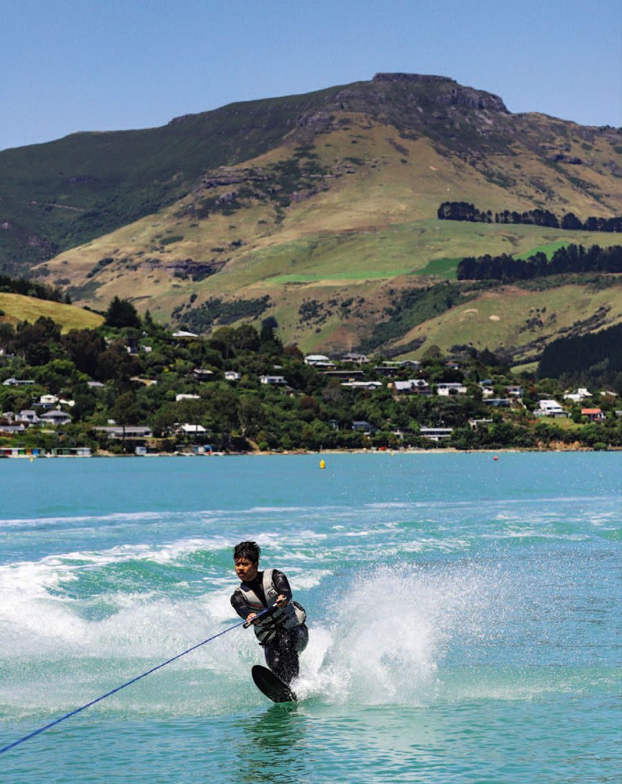 Skiing from Quail Island with Charteris Bay and Mt Bradley as a backdrop.
As well as the prevailing easterly, the other major consideration for boaties is the tidal nature of the upper harbour. Low tide renders many parts unusable and many people have been caught out by a fast-receding tide. Referring to a maritime chart for more detailed information on relative depths is always useful.
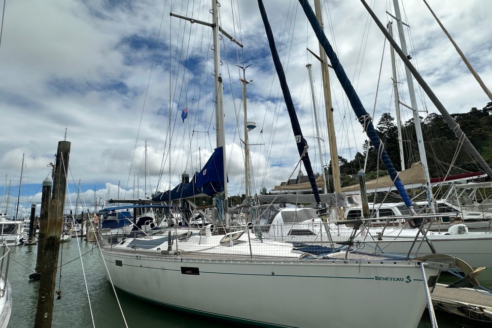
The marina and public boat ramp at Lyttelton is often the drop-off point for boaties. Sheltered and well-equipped, it can be a busy place over summer weekends and holidays. Kamautaurua Reef lies just off the slipway area and is well marked, but once clear of the slip, marina and reef, the entire harbour awaits.
Nearby Motukauatirahi/Cass and Motukauatiiti/Corsair bays are designated mooring areas and most of Corsair is reserved for non-powered craft and swimming. So, while warm, sheltered and popular for swimmers, it’s not of great interest to most boaties. Any voyages further up the harbour towards Governor’s Bay should really only be attempted at high tide.

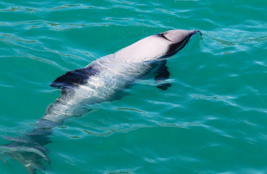 Hectors dolphins are a common sight inside the harbour
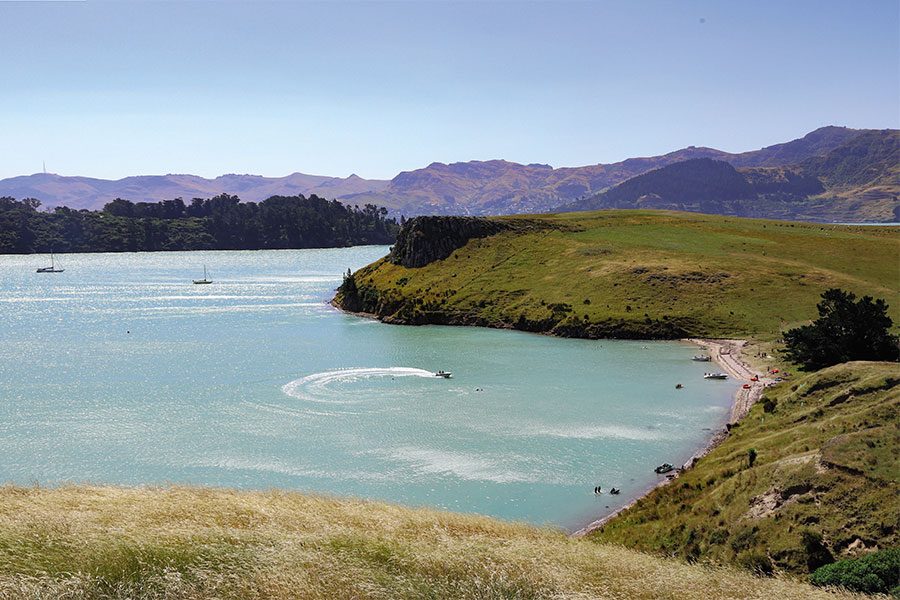
Otamahua/Quail Island is a highly popular location for picnicking and watersports either side of high tide. The main water-ski lane is largely sheltered from the prevailing winds and the island provides many alternatives to simply playing in the water. There are wonderful walks and its rich history is well-documented by the island’s many displays and signs.
The island hosted a quarantine station from 1875 until 1925 housing those with diseases including leprosy and it was also the site of dog kennels for Shackelton’s and Scott’s journeys to Antarctica. A ship’s graveyard containing the remains of a dozen ships is worth a look – either from the walking track or from a boat when the tide is in. The island is a very popular spot for sea kayakers and jet-skiers.
Boat access to the island is also available from the smaller – but scenic – public ramp at Te Wharau/Charteris Bay. A word of warning, however: this slipway is useable only a couple of hours either side of high tide. Plenty of boaties have been caught out here over the years.
 Craft of all sizes use the harbour.
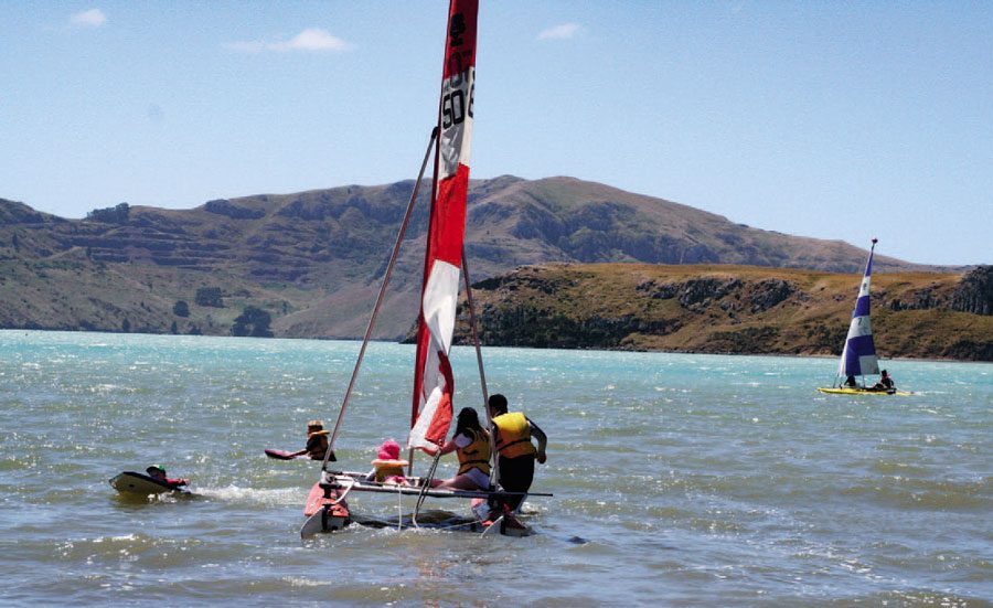
Charteris Bay is also home to a busy and family-oriented yacht club which, along with the Naval Point Club based on the Lyttelton side of the harbour, ensures the waterway is the scene of large regattas and events throughout summer. There is also a busy schedule of keeler events most weekends and some evenings throughout the summer. Naval Point is also home to a large Waka Ama fleet.
It’s often overlooked, but nearby Kaioruru/Church Bay also has a water-ski lane and even on blustery easterly days, it provides calm water for the family. Sadly, the location of the ski lane is against a rocky shoreline with no beach for picnicking. There is a small beach located at the head of the bay and away from the ski lane, but again, skippers need to be aware of the shallow nature of the bay either side of full tide.
Diamond Harbour is a beautifully sheltered mooring in easterly conditions and is home to about a dozen permanently moored vessels. The large jetty is popular with swimmers and young anglers, as well as being the arrival and departure point for the Diamond Harbour/Lyttelton ferry service. Boaties need to take care and not impede the commercial vessels. A short, steep walk up the hill provides access to a café and several shops.

 Lyttelton has a bustling port.
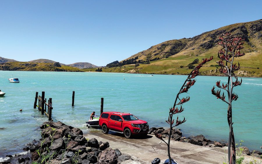
Just beyond Stoddart Point lies Purau Bay, another popular location for day-trippers. I’ve always maintained that if you can successfully use the Purau slipway you can use any slipway in Canterbury. The challenge comes not from the gradient or width, but the fact you’re facing into the prevailing NE wind, chop and – on occasion – a small but surging swell. At low tide launching a larger boat – say six metres and longer – can be difficult because the concrete ramp flattens out and then stops abruptly. Another complicating factor is the lack of adequate parking and poor ramp maintenance.
The nearby jetty can also be a challenge to berth against in the wind, so for those new to a day on the water with friends or family, using the Purau facilities can be stressful. Just take your time and don’t hesitate to ask for help if it’s required.
With the growing popularity of trailer boats in the region and ever more of them using the bay, it would be good to see serious work undertaken on the slipway and associated facilities.
 Punching into the prevailing nor’easter
Purau is a wide bay and the area close to the main beach is designated for non-powered craft only. The bay is popular with small yachts, kayaks, dinghies and swimmers and is also home to a large number of permanent moorings. It’s exposed to easterly winds but on the eastern side of the bay lies the smaller, sandy-shored Wreck Bay which, like Quail Island, is a popular for watersports.
In the late 19th century Wreck Bay was a ships’ graveyard. Although sheltered from the wind, navigation is limited by the tides and care needs to be taken. An outcrop of rocks halfway along the beach is submerged by an incoming tide so people visiting for the first time need to look out for them.
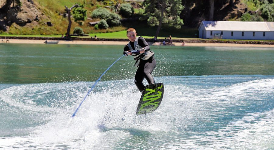
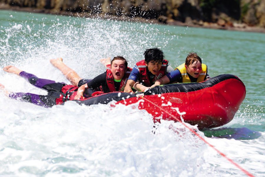
In recent years Wreck Bay has become a popular place to tow biscuits, skiers and board-riders so skippers need to remember the most basic of watersports rules when using the bay: drive anti-clockwise as you leave the shore! I still vividly recall one Waitangi Day back in the mid-1980s when 42 boats were using the bay. My father still shudders as he recalls trying to take us kids water-skiing amongst the throngs of boats and people!
 Fun at the Quail Island ski lane
Just around the headland is Ripapa Island, accessible only by boat but a ‘must visit’. Once a fortified pa for Ngāi Tahu and then a quarantine station, it was later used for coastal defences during the ‘Russian Scare’ and two World Wars. The site has been repaired and renovated over the last 10 years and with such rich history, it’s a wonderful place to spend an hour with the family.
I’m not a particularly sentimental guy but I do smile every time I boat into nearby Inainatu/Pile Bay; I have many childhood memories of joining my grandparents on their launch to attend Banks’ Peninsula Cruising Club Christmas picnics and other events. The quaint bay, home to a handful of small baches, offers shelter from the easterly, a sandy beach and water-ski lane.
The waters from here – on both sides of the harbour – to Awaroa/Godley and Te Piaka/Adderley Heads are exposed. An easterly headwind and chop can sometimes make for slow, bumpy progress on either side of the harbour, but in favourable conditions it’s a wonderful long run with plenty to see – large, swirling kelp beds, impressive rock stacks and exposed cliffs that are home to diverse bird and marine life. Hector’s Dolphins are ever-present in the harbour and can often be seen as far up the waterway as Charteris Bay. On occasions I’ve seen pods just off the beach in Purau. They’re strictly protected and need to be respected, so the usual rules of keeping your distance apply. They’re graceful mammals and an absolute joy to observe.
 Sea biscuiting at Wreck Bay.
Te Pohue/Camp Bay offers some protection from the elements and can be a lovely spot to anchor for a picnic and some fishing. The bay is also a 15-minute car drive from Purau along a windy, shingle road and marks the end of road access to this side of the harbour. It’s popular with swimmers seeking a sandy beach and quite often a rolling swell that breaks onto the beach provides some great body-boarding. Don’t think about bringing your boat ashore unless conditions are optimal.
Waitata/Little Port Cooper is a further 10-minute boat trip around the point and, bounded by Adderley Head, it marks the entrance of the harbour. It was once the site of an early whaling station. With no road access, it is isolated and a popular destination for sea kayakers. Again, this is a wonderful spot for a picnic, swim and fish. The farming family at Camp Bay offer several accommodation options at both bays – find out more via their Facebook page: Keirangi – Off the grid huts.
The other side of the harbour entrance is guarded by the sheer 120m-high cliffs of Awaroa/Godley Head. Interestingly, the cliffs around the heads on both sides of the harbour entrance experienced large landslides during the Christchurch earthquakes in 2011 and for years after the evidence of the earthquakes’ ferocity was all too obvious.
 Boaters enjoying Wreck Bay.
Recreational fishing in the harbour from a trailer boat can be challenging. The water’s often murky and the wind sometimes incessant. Sadly, the days of popping out for a few hours to catch an easy blue cod for dinner are gone. They’re still there but you need to work hard to find them. These days you’re more likely to catch red cod, rig, kahawai and the odd blue moki. Divers often target butterfish in the outer bays, where paua and mussels can also be found. Over the peak of summer kingfish can be targeted off the harbour entrance and further around Banks Peninsula.
Another consideration can be the appearance of a late afternoon sea fog that quickly rolls into the main harbour from Pegasus Bay, often considerably reducing visibility and rapidly lowering the air temperature. This can be unnerving for new boaties.
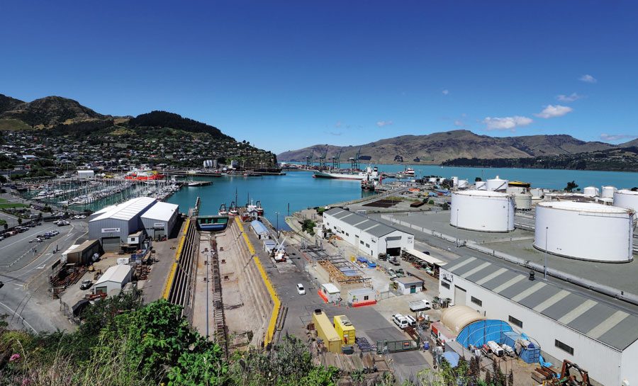
Lyttelton Port welcomes vessels and cargo from across the globe and until the earthquakes was a popular stop for cruise ships. After extensive and expensive work to repair damaged infrastructure cruise ships are expected to return. All the action at a modern, busy port are easily observed if you cruise slowly around the wharves, but it’s a seven-day-a-week, 24-hour-a-day commercial operation, so be considerate.
 Purua Slipaway.
The harbour’s main navigation channel is regularly dredged and clearly marked. The only notable navigation risk is Parson’s Rock which lies off Ripapa Island and it is also well marked. Lyttelton Port Company tugs and the pilot boat are regularly observed in the harbour accompanying large vessels. Communication is available on the usual VHF channels and if you’re wanting an up-to-date view of weather conditions on the harbour, the port company also has a number of publicly viewable webcams. Coastguard has a base at Lyttleton and its vessels are a welcome and reassuring sight as they regularly patrol the harbour and beyond. Coastguard is contactable via VHF Channel 63.
If you take the time to explore this unique harbour, like me, you’ll likely discover more boating opportunities than you ever imagined. BNZ


