In 1953, with the stroke of a pen, the most important ocean on the planet disappeared.
The truth is the Southern Ocean had been shrinking for some time, retreating south and being eroded in increments. As gales roared over its waters and legions of albatrosses wheeled across its skies, bureaucrats and policymakers were busy plotting its demise.
It all started back in 1914 when the newly-formed International Hydrographic Bureau attempted to agree on borders and names for the world’s oceans and seas. Although this sounds like the basis for a Monty Python skit, it was a serious attempt at defining ownership of the unownable. Ten years later, in the great human spirit of letting nothing be wild and free, the Bureau produced a publication entitled Limits of Oceans and Seas.

Captain James Cook was one of the first to prove that the southern region of the globe was composed of a single great ocean. This came as a disappointment: he had been hoping to find the fabled continent Terra Australis.
When his voyages of the late 1770s produced nothing but endless sea dotted with tiny islands, the ocean was given over to whalers, sealers and sailors. These men gave it a multitude of names, among them Great Southern Ocean, Grand Ocean and the frighteningly descriptive Southern Icy Ocean.
Things remained that way until 1919 when the Bureau officially named it the Southern Ocean. Its northern boundary was drawn to neatly touch the coasts of South America, South Africa, Australia and New Zealand.
The naming of the ocean gave formal recognition to what every sailor had known all along – that this was a singular, distinctive and significant body of water − but the Bureau
was never to reach such heights of common sense again.
At each subsequent meeting, it pushed the boundaries of its neighbouring oceans south, until in 1953 the Southern Ocean disappeared altogether.
Since then there have been attempts by the International Hydrographic Organisation – as the Bureau was renamed in 1970 – to reinstate the Southern Ocean but disagreement has always broken out among the delegates. Today such disparate parties as Encyclopaedia Britannica and the CIA recognise the Southern Ocean while the National Geographic Society chooses to ignore it.
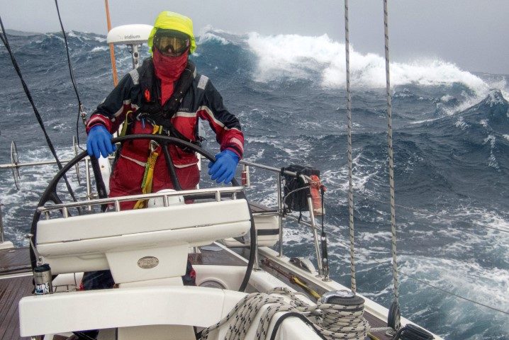
As you may have guessed, all this naming and drawing of boundaries is complete nonsense. The Southern Ocean has a presence that moves north and south with the seasons. Its howling west winds can reach up as far north as 35° South latitude in the southern winter and retreat as far south as 50° South in summer. For those who sail there, the ocean is felt as an unnerving and almighty power, a tightening somewhere deep in the gut.
It was the sailors who frequented these waters in the days of sailing ships that named the latitudes of the Southern Ocean – the Roaring Forties, the Furious Fifties and the Screaming Sixties. They were describing the only thing that matters in this ocean, wind.
These were no sailor yarns, like those of sea serpents, dreamed up to scare the pants off landlubbers; these winds were real and went some way to making this the most feared ocean on the planet. Even today, among sailors, to say you have sailed the Southern Ocean is equivalent to describing a descent into hell. Their eyes will be bright and they will take you aside and ask “What was it like?”
That the Southern Ocean is one of the most consistently windy stretches of water on Earth is largely due to heat and pressure. The equatorial regions receive the vertical blaze of the sun and so have an excess of heat. The polar regions have a deficit of heat. Wind is the atmosphere’s attempt to even out the difference, like the thermostat of an air- conditioning system.
Where the air is cool it descends, causing high pressure; where it is hot it rises, causing low pressure. Because the planet is rotating the big masses of air and water do not follow a straight line but rather a spiral, which whirls towards the left in the southern hemisphere and toward the right in the northern hemisphere. This gets complicated very quickly and is the reason meteorologists earn their money.
Over the interior of Antarctica, it is cold, which means the air can do only one thing and that is descend. On the edges of this large polar high there are low-pressure systems that drag warm air south and shunt cold air north as they spin the relatively warm sea air upwards.
Seen from the expansive view of a satellite map it looks like an icy kingdom surrounded by a marauding pack of spinning hounds which circle it, like the perimeter fence of a drug lord’s mansion.
It is the northernmost edges of this pack of hounds, known to meteorologists as ‘deep low-pressure systems’, which force a continuous flow of wind from west to east. As each low-pressure system passes, the flow goes from the warmer north-west to the cooler south-west and back again; always some version of west and always lots of it.
The waves these westerly winds generate are among the largest on the planet. The strength of a wind and the distance it has travelled − a combination known as ‘fetch’ − determine the height of waves.
A small lake has a short fetch so it is capable of generating only a sharp chop, even in strong winds. An ocean such as the Atlantic has a few thousand nautical miles of fetch so it can generate a sizeable swell. When the Drake Passage opened up 30 million years ago it gifted the Southern Ocean an infinite fetch.

This is the one ocean that has no land to break up the sea’s endless circuit. Even on the calmest days, it has a constant heave from the west. On the worst days, the size of the swell can make your heart stop.
All that wind has an effect on the surface water of the Southern Ocean. The Antarctic Circumpolar Current, like the wind, is in a constant drift eastward. Measured at 11,332 nautical miles long it is actually a continuous loop that moves over 130 million cubic metres of water a second. That is over 100 times the flow of every river stream and creek on the planet combined!
It is one of the major redistributors of energy, like a giant flywheel at the bottom of the world keeping the air-conditioning system going. This circumpolar current is also the baseline which drives the Indian, the Atlantic and the immense Pacific Ocean gyres which reach up as far as the equator.

Below the surface currents of the Southern Ocean, there are other currents, driven not by the wind but by differences in density. Antarctica is one of the few places in the world that produces deep water; this is the cold salty water that forms as the sea ice leaches out its salt and is the densest seawater on the planet.
Its density allows it to sink to the bottom which averages about 4,000–5,000m deep for most of the Southern Ocean. This sets in chain the circulation of the entire world ocean system. The only other place that can boast the production of deep water is Greenland. While the circulation of the world’s oceans is an endless conveyor belt, it is believed that deep water formation is critical to kick-starting and maintaining this immense transfer of energy.
You don’t have to sail the Southern Ocean to guess that with all this water moving about there will be some spectacular collisions. The most impressive is the Antarctic Convergence zone, where cool dense Antarctic water moving north meets the relatively warmer water of the Subantarctic and creates an undulating ring of confusion up to 26 nautical miles wide around the Antarctic continent between latitudes 48° and 61° South.
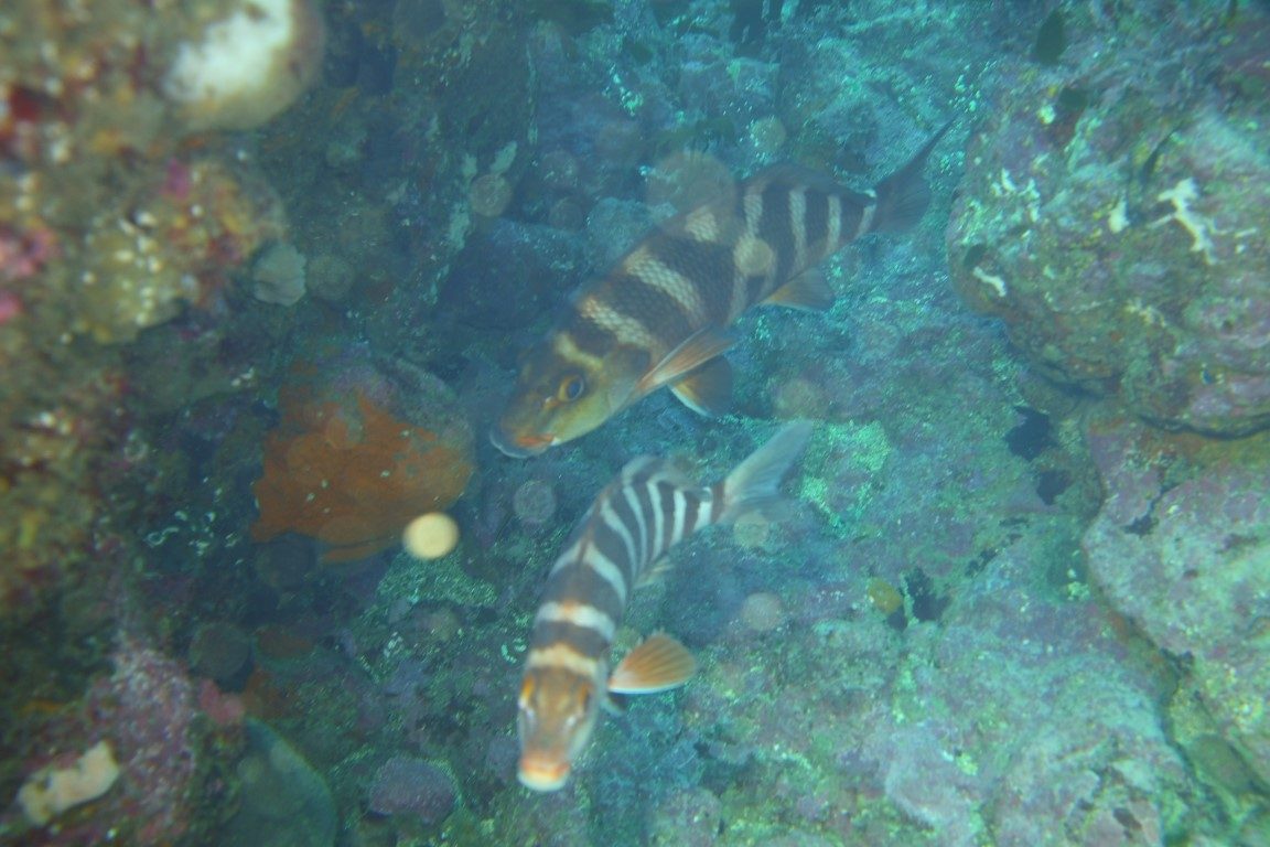
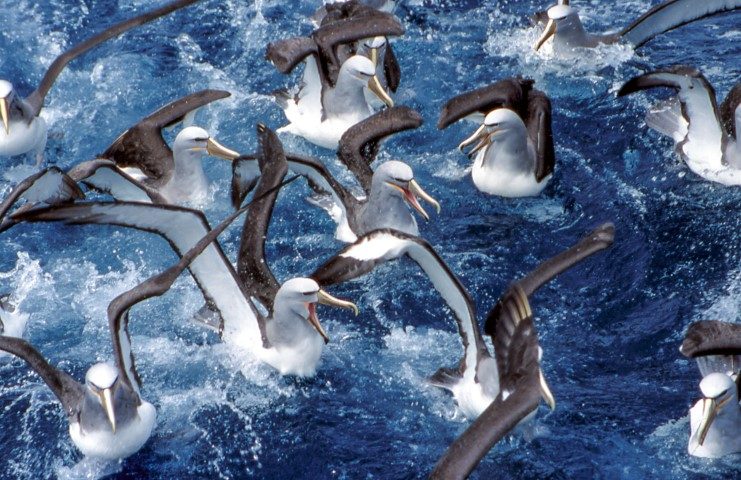
As the Antarctic water drives under the subantarctic water, the vigorous mixing that results brings bottom nutrients to the surface, making the place one of the most productive zones in all the world’s oceans and a bonanza for marine life.
For those who venture across it, the convergence zone denotes a change in the soul of the Southern Ocean. South of it the sea temperature drops, the fog rolls in and all hope of the north is lost. Things get serious with little chance of rescue: there is now a vast distance between you and the rest of humanity.
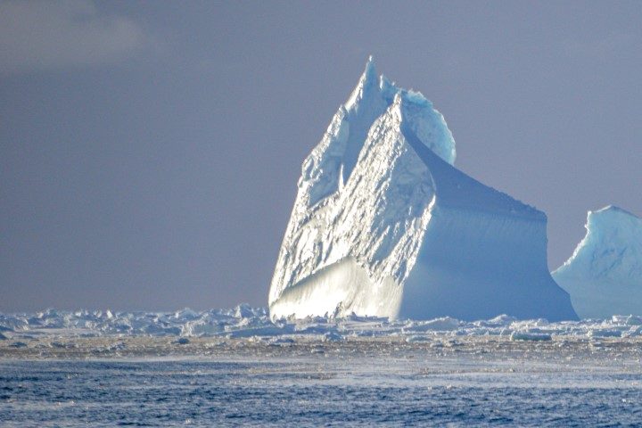
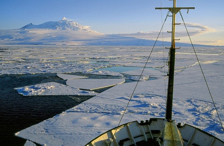
Further south again and the first of the sea ice is encountered. At about -1.8oC seawater freezes and forms pancake patches of ice that congeal into a solid frozen surface up to 120cm thick.
As winter approaches, vast swathes of the Southern Ocean freeze over, expanding the footprint of the Antarctic continent by up to 20 million square kilometres. By late January the ice breaks up and is flushed north to dissolve into the wider Southern Ocean. This expansion and contraction create one of the largest annual events by mass on the planet.
If you speed up satellite images of the growth and disintegration of sea ice on a computer, what you see has a remarkable resemblance to a beating heart. This could be dismissed as the pure fancy of a Gaia theorist were it not for the fact that, beneath the vast structure of winter sea ice, a miniature upside-down forest of marine growth forms each spring as the sun penetrates the ice, injecting large quantities of biota into the Southern Ocean.

Despite all this physical enormity, we still know very little about this ocean. It circles Antarctica and acts as a violent mixer of the earth’s air and water. It is the one ocean that links all of the others; it is the one feared by sailors. Despite this impressive collection of traits, it remains firmly incognito.
While we could blame the International Hydrographic Organisation for this, there’s also another reason. On this ocean, humans can exist only in transition. The idea of real settlement is absurd: staying put is hard to achieve in an ocean hell-bent on picking you up and tumbling you east.
So the ocean sits well out of sight at the bottom of the world, and any eyes drawn its way are blinded by the gleaming white of its glamorous companion, Antarctica.
https://boatingnz.co.nz/wp-content/themes/magazilla/framework/admin/inc/img/image.png